Background photo credit: WeForest
In the Copperbelt, Zambia’s most densely populated region, forests have been disappearing rapidly. The WeForest team, who strives to restore forests, has identified that making the indigenous forest economically viable was a major problem in one of the districts, Luanshya.
We talked to Matthias De Beenhouwer, a project manager at WeForest who is currently working on a large forest restoration project in Zambia. He and his team are using GIS Cloud to improve their daily workflow in planting trees, as well as educating farmers on the effects trees have on the environment and the global climate.
Bringing back forests to make Earth cooler
WeForest is an international organization dedicated to planting trees and bringing back forests to make Earth cooler. They use and develop innovative, scalable, and lasting solutions in restoring forest landscapes in different parts of the world – Brazil, India, Zambia, Ethiopia, Burkina Faso.
Restoring forest landscape creates a long lasting impact on local communities as well on the global climate as the trees absorb the excess carbon dioxide from the atmosphere and create clouds that reflect the solar radiation back into space.
Holistic approach to forest restoration
The forests in Zambia weren’t perceived as economically viable, the reforestation activities weren’t enough to provide a sustainable solution for the local community. So, WeForest team introduced a holistic approach to the forest restoration process where they integrated education of farmers on the economic potential of the forests with ecological restoration.
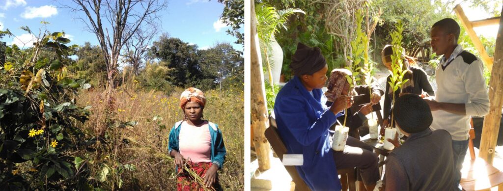
They are supporting farmers to restore the native Miombo woodlots (plots of native woodland on farms) while introducing economic activities such as bioenergy and honey production. These activities not only support the forest restoration process on a long-term scale but also bring benefits to the local population – diversified jobs, higher incomes and new skills.

Photo credit: We Forest
The challenge: mapping trees and tracking progress
For the Zambia project, the WeForest team needed an innovative solution for doing the complex tasks in the field, such as mapping trees and tracking a particular farmer’s progress in a more efficient manner, as well as improving the outcomes of the project by having a better overview of the data.
The crucial information they need to have to improve the outcome of the project is knowing on which scale the forest restoration is taking place, and to know how much land is coming under restoration.
Tracking and visualizing the progress was necessary for ensuring the transparency of the project, crucial for WeForest supporters and partners. At the same time, a good data collection method and visualization of the collected data was essential for the efficiency in team coordination, tracking and collecting data, and prioritizing the tasks on a daily basis.
To sum it up, the WeForest team in Zambia needed a solution for collecting and visualizing the data to:
- Track field visits by their technicians in the field
- Monitor progress and track details of an individual farmer in real time
- Know the exact number of hectares restored
- Coordinate teams, plan actions and mark forest boundaries
The solution they were looking for needed to be easy to use, to ensure a smooth transition to a new workflow, while improving the efficiency of the field team.
Easy-to-use online GIS solution
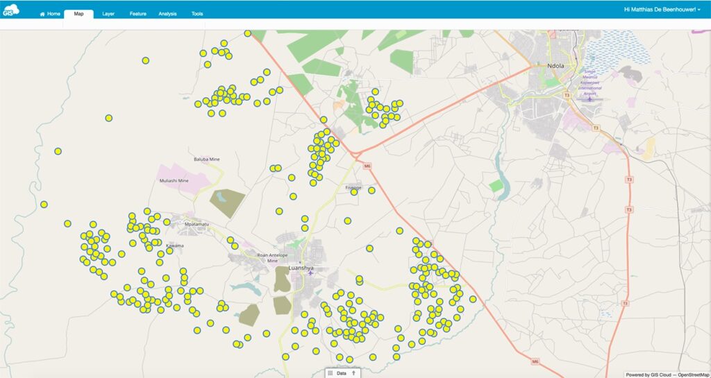
WeForest team used the GIS Cloud Mobile Data Collection app to collect the socioeconomic data and progress on the reforestation of each farmer. It allowed mapping farms and trees in the Luanshya District in Zambia and sending data to the cloud in real time.

Map data credit: WeForest
The data was instantly visualized on an interactive map in GIS Cloud Map Editor app. This means that the data was easily accessible from any device and at any time by the WeForest staff, project managers as well as the local partners, sponsors, and donors if necessary. They could view data about which hectares are planned for restoration, reforestation progress, data about farm boundaries, farmer’s details and economic activities.
GIS Cloud provided the WeForest team user-friendly and cost-efficient tools to transparently communicate the reforestation plans and results with their sponsors and donors, and show how the funding has been used in the project.
Moreover, their data collection process was much more efficient, the implementation of the new workflow required no additional training, as the app was easy to use both for technicians in the field and those who visualized the results. They managed to reduce the errors in data collection process with pre-defined forms, and saved a lot of time on data digitization as the information was sent to a map directly from the field, and observable in real time.
An additional benefit was the capability to add photos to the project and customize the data collection fields for the interviews with farmers.
The 3 key features for which Matthias De Beenhouwer recommends GIS Cloud are:
- Flexibility to do your customized projects within the apps.
- GIS Cloud comes with excellent customer service.
- Enabling visibility and transparency to projects.
Interested in utilizing Mobile Data Collection for your field projects? Sign up for a free trial or contact us here.


