Orange County California is comprised of eleven watersheds which drain to 42 miles of sparkling blue coastline and sensitive wetlands such as Upper Newport Bay and Bolsa Chica. There is a lot of interest in protecting and preserving the health of these resources and volunteer cleanup events have become an important part of this effort. In order to optimize the effectiveness of volunteer cleanups, the need for a user-friendly, cost-effective data management solution that could collect and share data in real time was identified.
The OC Watersheds Division of OC Public Works, which helps organize several volunteer watershed cleanup events each year in Orange County, decided to see how GIS Cloud technology could help.
Challenges
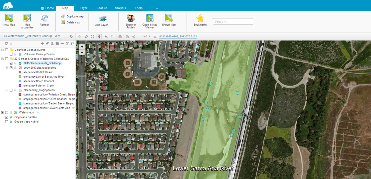
The solution OC Watersheds had in mind for cleanup event was a simple and user-friendly data collection app that can have a form for populating predefined fields. The form would need to have the option of collecting photos, audio, location coordinates, and information on when data was collected (time – date). They also wanted to have a mapping tool that would show volunteers the locations of different cleanup events. At the same time, they wanted the mapping tool to show data collected from the field in real time.
- User friendly way of mapping areas of interest (that would need to be visited by volunteers)
- Easy to use solution for data collection that doesn’t require GIS knowledge
- Possibility to see changes from the field in real time in office to follow the progress of volunteers
Solution
Map Editor and Mobile Data Collection Portal provided OC Watersheds the ability to create custom forms with as many fields as they needed. By accessing the predefined form in Mobile Data Collection app, the effectiveness of the volunteer watershed cleanups can be analyzed on a spatial and temporal scale, and there was no prior GIS knowledge required. MDC app enabled the collection of different data such as the type of trash, latitude, longitude, amount of trash collected, photos and audio recordings. Areas that volunteers cleaned were defined in Map Editor, which also allows the data to be tracked over time, showing progress in real time.

Results
- Possibility for creating custom forms with as many fields as necessary
- Accurate and current information about trash deposits in watersheds, accessible on any device from the field or office in real time
- User-friendly solution, easy to use by non-GIS experts


