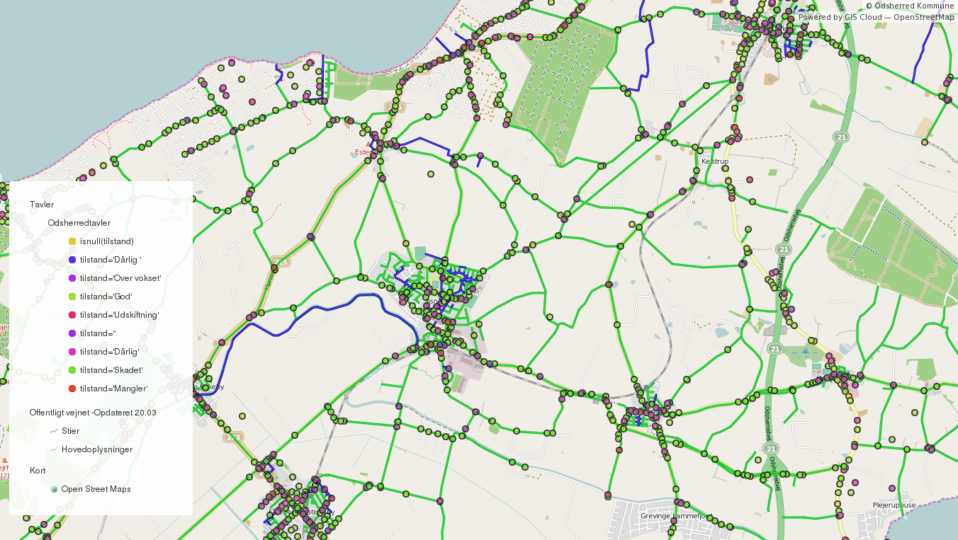
Odsherred is a peninsula in the north-western part of the island Zealand (Sjælland) in Denmark, stretching from the Sjællands Odde in the north-west to the now drained fjord Lammefjord in the south. It covers an area with a wide range of the most typical Danish landscapes such as long sandy beaches, small rolling hills and much farming.
Odsherred Kommune started a search for more innovative mapping solutions that would help them to start two separate projects at the same time:
- Road Infrastructure Collection and Maintenance project
- Data Publishing project
Different levels of maintenance that needs to be done upon collected data from the field from left to right: overgrown (overvokset), damaged (skadet), good (god)
With the first project they wanted to be able to collect data about road infrastructure with tablets and smartphones in real time. Additionally they wanted to have an option to revisit the area/asset and update its current condition on the spot. With the second project they wanted to find a way to show green areas in the Kommune to private companies who would then have an insight of the location and size of the green area. This way they could make an estimate cost of landscaping that needed to be done for the given area.
“We have chosen the GIS Cloud platform for its unparalleled speed and performance. The variety of tools, mobile and online data publishing possibilities makes it a standout among GIS solutions and again with an unparalleled pricing and customer support. The platform is light, fast and in rapid and continuous evolvement.” Peter Hagesø- Road Engineer and Budget Officer
Although these are 2 separate projects, the idea was to have a solution that would make decision making interactive and interoperable between various departments and companies.
Challenges
- Possibility to collect data about road infrastructure with tablets and smartphones
- Option to revisit existing road assets and update its current condition
- Simple, fast and intuitive portal to give accurate and relevant information about the green areas to their contractors and citizens
- Must be able to use already existing data such as Mapinfo and Geomedia file formats
Solution
GIS Cloud Mobile Data Collection was the first tool Odsherred Kommune found to suit their needs. With the option of having multiple users collect and edit the data simultaneously in the field, the progress could be seen in real time in the office. Creation of custom forms made the data collection process faster and automated, having all the data consolidated in one repository. Map Editor enabled them to edit, style and enrich (different types of media) the collected data, as well as upload existing data in Mapinfo and Geomedia formats. Next step was to have their data published and publicly accessible. By having a public, white labeled and custom Map Portal, multiple layers could be displayed, showing different types of information, making their everyday workflow faster and interactive.
Results
- Real time data collection with the ability of editing data in field and work in an offline mode
- Customization of data collection forms
- Possibility to render maps with millions of features
- Possibility to import and export data in various vector and raster formats like Mapinfo and Geomedia files
- Option to associate media files to location data
Click here to see the Odsherred Map Portal!


