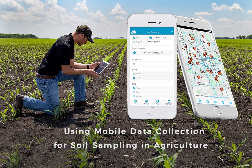
The Mobile Data Collection app replaces messy field paperwork with easy-to-use mobile forms. After you fill the form at a sampling location, the data immediately appears in Map Editor, where you can edit and analyze the data.

In the past, farmers would spread the fertilizer evenly across the entire field. But with geospatial technology, producers can now analyze the soil data with historical farming practices and determine the right amount of fertilizer to improve the soil nutrient levels for different types of crops. Farmers can also decrease the amount of fertilizers in certain areas and record the quantities for each crop type. The soil sampling data allows farmers to make informed decisions by measuring the effects of fertilization and monitoring farm conditions.
GIS Cloud also works great with remote sensing technologies. Learn all about it in this article about crop damage assessment.
With the Mobile Data Collection app (MDC) you can record soil sampling data on custom form templates suitable even for non-GIS users. You can precisely mark and locate soil sample points in the field, online or offline. Use the Map Editor to easily import and sync lab results to review existing historical data. Also, you can identify the spatial patterns and correlations between soil nutrients, soil types and crop inputs.
Key Data Collection Features For Soil Sampling
Create custom forms
In the MDC app, you can create custom forms for different data collection scenarios. An MDC form is a structured PostGIS database that automatically georeferences the data to the map. Users can collect various types of attribute data such as date and time of sample collection, soil types in the predefined select list, nutrient availability, crop characteristics, coordinates and take notes or photos.
Collect and edit soil sample records
Field workers can mark the location of a soil sample with the app GPS, with the pinpointing tool or by using an external GPS device. The MDC app will record a location for every soil sample. You can also make fast updates and edits to your data in the field or the office.
Work and collect offline
Even if you don’t have an internet connection in the field, you can collect data offline. Download the map on your device before you go in the field, collect the data and sync them when you return to the office.
Sync the lab results with the soil sample locations
After you get the soil sample lab results, you can import CSV data to the Map Editor and then join the data with the soil sample locations to get a better overview of the soil nutrient levels in different areas of the field.
Identify spatial patterns and Add raster data
Spatial selection tool allows you to build spatial queries for the map layers. You can compare attribute data as well as location data to analyze and identify the patterns in crop production. You can also Import raster data such as multispectral orthophoto or NDVI of your field to determine which areas require immediate attention.
Search and review historical data
You can review historical sample data by ID number both in mobile and web applications. Farmers can precisely determine the amounts of resources (fertilizers, pesticides and herbicides) they should use to increase the agricultural productivity of their crops.
Find out how our client form Greece, NubiGroup, is using GIS Cloud technologies for precision farming in this article.
Interested in using GIS Cloud apps for soil sampling? Contact us or sign up for the free trial.


