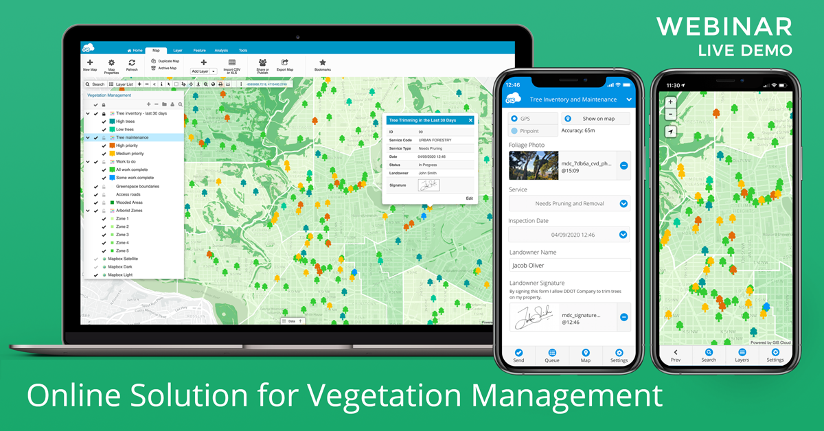
We have held a free webinar/live demo showing you how to organize your vegetation management project. It was a step-by-step guide on the best field and office workflow with live examples and suggestions for organizing your vegetation management, crew & job coordination within the GIS Cloud platform.
Including these processes and online collaboration in your organization can help you quickly deploy and efficiently execute projects and reduce operational costs!
We have covered important topics concerning vegetation management like tree inspections, workforce & client enablement, analysis, and project planning.
Check out this webinar if you are confronted with extensive administrative and field paperwork, data accuracy concerns, difficulty tracking and visualising field data, and challenging team coordination.
Arborists, utility vegetation managers, landscapers, forestry managers, tree care specialists, and various other vegetation management professionals can find out how to:
- Create and set up your custom forms (surveys) for the field data collection on trees and vegetation. Attach your photos and media, and sign off your work forms with an electronic signature.
- Share this project and form with your colleagues and field crews for data collection and collaboration for tree maintenance, disease and growth monitoring, worksites identification, disaster and risk assessment response, pruning, mulching, etc.
- Share the project whit clients and stakeholders to review and identify high-risk / high-cost vegetation areas in real time. Improve your crews work productivity, maintenance and decision making.
- Visualise and analyse the map data with colour coding and custom symbology to prioritize job and risk assessments of hazardous trees, diseases and growth monitoring, pruning etc.
- Plan and budget your project in real time. Learn to reduce the initial costs of modifying operations in your organisation for greenspace analysis. Cover your climate impacts, bloom periods, coverage, future planning, damage reduction, allergies, seed pollution etc.
- Learn to build a cloud-based vegetation inventory accessible at your disposal from any device at any time.
- Learn to organise your field workforce, save time and money on your projects with advance prioritisation, job assessment, site navigation, where to park or what route to take with our navigate feature, coordinate permits and work orders.
Real-time data collection, inspection and editing, proper field communication, and decision-making can help you build up and grow your organization faster, better and smarter by saving time and costs.
Having a clear overview of issues in the field and ongoing projects helps you win tenders, reduce future costs and modify your vegetation management actions and operations.
In case you already have an operational system in place, we can help you seamlessly integrate with your existing software and solution, like ArcMap, QGIS o any other custom software.
Why GIS Cloud?
- Fast onboarding and map engine
- Accurate cloud-based inventory management
- Workflow digitalization
- Geocoding
- Geolocated photo database
- Census data ingegration
- Operational visibility
- Real-time data overview
- Proof of concept and jobs done
- No previous GIS experience needed
- Education / services & support
- Online/offline maps
- GPS / Pinpoint tool
- Navigate to feature or POI
- Raster imagery + ogc formats
- Ad hoc and quick project surveys
- Fast adoption time
- Android / iOS supported
- No additional installation process
- Cloud-based (online)
- Custom reports
- Custom search/filter
- Media attachments (including google doc links or work order documents)
- And much more!
Create your GIS Cloud account for free to learn how to bring crucial project issues to your team’s attention in real time with the help of GIS Cloud apps and services!


