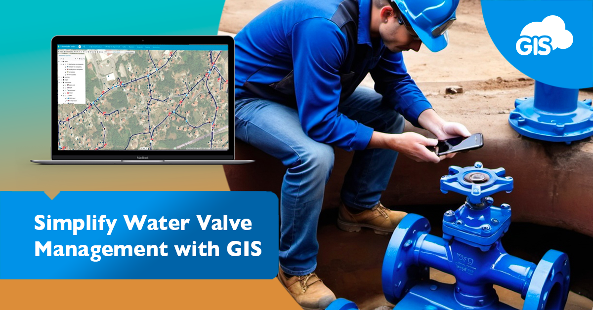
Are your operators using paper maps to track their routine water valve exercises? Do they have company issued smartphones?
It’s time to upgrade the workflow.
We are going to show you how easy it is to inventory your valve exercises with a mobile app. It doesn’t matter if you have an Apple or Android device.
In with the shredder and outside with your smartphones
Why are we exercising these valves, Boss?
If you aren’t familiar with valve exercising programs, we’ll briefly cover them.
Exercising valves is an important regular task performed by the staff of utility companies. Water valves control the flow of water.
Checking on valves everything so often is to make sure they work properly. Over time, since valves are sitting in water, they can build up material, including calcium and tubercles.
By exercising the valves, we can remove any build up as well and inventory the condition of a valve. Valves are expected to perform a certain way. Each different size takes a certain number of turns to close.
Plus or minus a turn, it takes about 18 turns to fully open or close a 6” valve. It takes about 24 turns on an 8” valve.
The rule is generally to multiply the valve size by 3, give or take a turn.
That formula doesn’t work on the bigger sized valves.
Water shut offs occur during water utility construction and pipe bursts or other occasions.
By having properly operating valves, water managers can limit the loss of water during accidents and minimize service interruption to customers.
If the nearest valves aren’t working properly, a larger number of customers will be impacted by the water shut-off.
Water valve exercising inventories are a great time to identify any potential problems like damaged or malfunctioning valves.
Water shut-off events require the impacted public to be notified. That’s another place GIS can help identify the impacted parcels using analysis tools.
Now let’s leave the water utility management to the professionals and move on to what we are experts in: GIS and data collection.
Data Collection For Your Valve Exercising Program
Part of a good valve exercising program is the data collected during the process. This data tracks what issues need to be addressed and ensures the valves are properly tested.
Many water districts still capture this information on spreadsheets or paper maps.
We are going to show you how you can collect the necessary information in the GIS Cloud Mobile Data Collection application. All the information you used to write down can be entered into a database on your phone.
Back in the office, you’ll be able to export the data to a CSV or Excel spreadsheet.
The data you collect can include the standard inventory information. This includes:
- Valve or Asset ID
- Year Installed
- Size
- Asbuilt Link
- Date Exercised
- Valve type
- Current Position (Open or Closed)
- No. Of Turns to Close
- Turns taken
- Condition of valve
- Did not close
- Could not operate valve
- Valve nut damaged
- Valve nut spun freely
- Valve stem cap missing
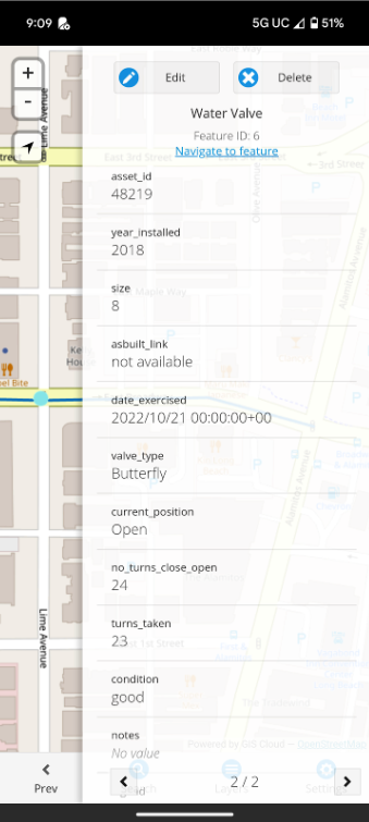
If you think of any additional information you need, you can add the fields using the Map Editor.
Your team can attach photos to the valve point. You won’t need to write down the filename or location and guess which photo goes with which valve back at the office. All that information will be captured in the MDC app. The photos will be linked directly to the valve.
Tips on how to get the most out of the MDC App when Valve Exercising
These are a few quick tips for speeding up the data collection process and solving some issues you may have experienced with paper work orders and printed out maps.
Tip #1 – Create a Catch All Attribute Field
I like having a “Notes” field on all my field data. I use it to collect any information that might not fit the other fields. Or it could be used as extra space for a different field.
You never know what you’ll find in the field, so a backup field is great to have.
Tip #2 – Capture multi photos
When you are in the field, you can see the environment around the asset. Back in the office, you won’t have that luxury.
Taking a photo of the asset from multiple directions will help give a more complete understanding of the area and situation.
When we collect data, we will capture area photos from different angles, the asset from a few feet away, and then a close-up of the asset. That last photo will usually capture the Asset ID if it is present on the asset.
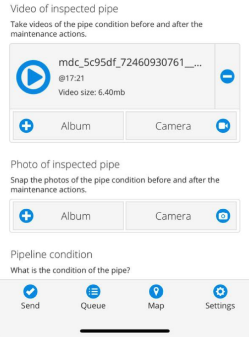
Tip #3 – Create default values
Defaults on new data points speed up the data collection process. You may only need to make a few changes, but ideally, the majority are defaulted to the correct or most frequent answer.
In this case, we are going to set our default value for water valves to “open”. Unless something is going on, valves are open to allow water flow.
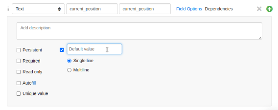
Tip #4 – Build drop-down lists
Drop down lists give you a list of predetermined options. For valve types these can be the common types, for example: gate, butterfly, or ball.
Others can be common issues you may expect to find in the field. The valve position, open or closed, can be used in a drop-down.
Here we have a drop-down for the condition field:
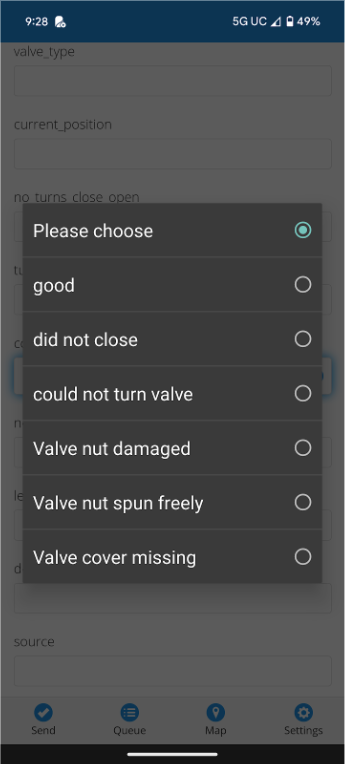
Drop-down menus are great for keeping your data consistent and removing entry errors while simplifying and speeding up the data collection process.
Conclusion
A GIS mobile solution needs to be as reliable as a properly operating valve. Let that be GIS Cloud’s Mobile Data Collection application.
Right now, we are offering our premium tools, like Map Portal and the MDC application, as part of our free 14-day trial.
Sign up today and start digitizing your paper maps before your next valve exercising inventory happens.


