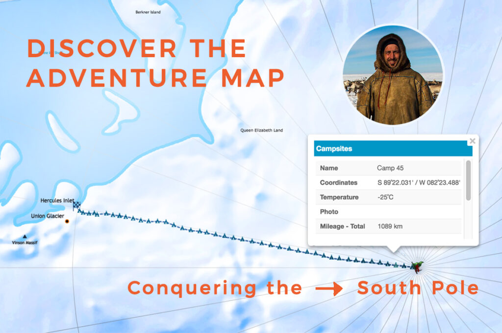
Once we heard that the renowned Croatian adventurer Davor Rostuhar had taken it upon himself to conquer the South Pole on foot, we didn’t hesitate much before deciding to support the adventure by doing what we are best at – mapping the expedition. The expedition was tracked from the Antarctic shores to the South Pole, successfully reached in January 2018.

The first Croatian South Pole expedition on foot was the perfect cause to support directly from our office in Croatia’s capital, Zagreb, so we were thrilled to track the daily progress on a map embedded below.
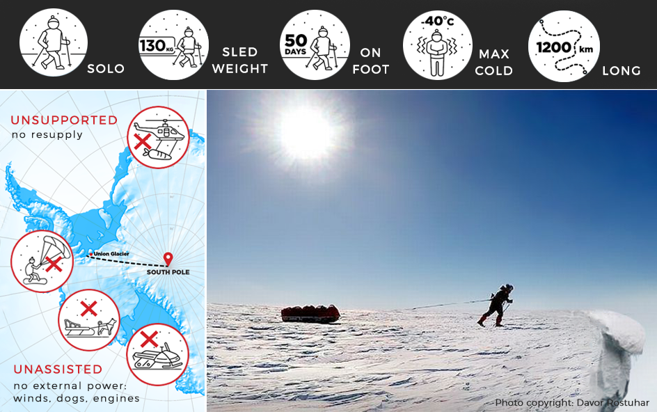
Before Davor, only 23 people from 9 countries had managed to cross the distance from the Antarctic coastline to the South Pole by foot and without external support. The easiest route from the coastline to the Pole takes 1200 kilometers. Prior to the South Pole conquest, Davor Rostuhar already had an admirable track record of travels and expeditions around the world. His journeys included biking 8000 kilometers from Zagreb to Egypt, conquering the summit of Mount Blanc and hiking to the highest volcano in the tropics – the top of Coropuna (6425 meters). Davor has traveled to 100 countries and led 30 expeditions while working as a journalist, photographer and writer, publishing stories in National Geographic, Geo, and other magazines. His endeavors are documented in six travel and popular science books. One yet to come will be dedicated to the South Pole expedition. In his own words:
I’ve been dreaming this „Polar Dream“ ever since I started travelling, 16 years ago. I’ve been dreaming of walking 1200 km from the coast of Antarctica to the South Pole – solo, unsupported and unassisted. It is one of the remotest and most desolate parts of the World, and probably the last true wilderness. I’ve been dreaming this dream ever since I first tasted the freedom of travelling, and for the last two years I’ve been preparing intensely for this remarkable endeavor.
Davor prepared for the expedition over the course of two years and was funded by his crowdfunding campaign “Polar Dream”, which reached its goal on July 3, 2017. Before starting off the expedition in December 2017, he visited northern Siberia, northern Greenland, Svalbard and Norway, where he gained knowledge of how to deal with the cold and inhospitable environment directly from those who traditionally live in such conditions: the Inuit, Nenet and Sami.
The expedition took 47 days and was filled with numerous challenges – blizzards, harsh wind, and extreme cold among them. Furthermore, Davor only had the help of a sledge to transport his 135 kilograms of equipment. Finally, on Wednesday, 17 January 2018 at 17:28 hours GMT, his challenging journey was successfully completed. Davor regularly updated his journal during the expedition. Details about the journey (In Croatian) can be found here.

Mapping the Polar Dream
As a technical support for the ‘Polar Dream’ project, our team of mapping experts at GIS Cloud had the task of creating a map of Antarctica. It was important to map all the main strategic locations and campsites to serve as a basemap to track daily progress along the way.
Due to Antarctica’s position, it was important to set the correct projection for vector and raster layers and map to minimize the distortion of surfaces and distances in the polar region. All the data needed to be georeferenced first and assigned with a Polar Stereographic projection. After georeferencing the data, layers were imported in GIS Cloud Map Editor application, which supports most of the global and local projection systems.
View more detailed map here.
After the initial modifications, it took only a few hours to finish the appearance settings and to complete the map visualization of the Antarctic region. The main piece of information on the map is the location of campsites. The data was updated daily to track the mileage progress and to record the route that was taken to complete the Polar Dream Expedition. Besides that, it was important to label the surrounding landscape details, such as mountains, land names, sea names, and islands to get a better idea of the morphology of the terrain.
If you are planning challenging expeditions like this one, it is essential to have great organization skills and a good preparation plan. Having an online mapping solution to track your progress, upload documentation, update the data and to share it with the public, can definitely be a useful addition to your endeavors.
For more news from GIS Cloud, follow us on Facebook, Twitter and LinkedIn.


