Artificial intelligence has recently hit the mainstream with tools like OpenAI’s ChatGPT and Midjourney. These AIs are improving workflows worldwide. GIS and spatial analysis have now integrated AI into their systems.
With the latest developments in AI, you can leverage GIS and AI together. We will explore how AI can use GIS and its data to perform important tasks.
Data Analysis
Data analysis refers precisely to interpreting and assessing data sets, much as its name suggests. By scrutinizing these data sets, valuable insights and patterns can be uncovered. Artificial Intelligence (AI), however, has the potential to enhance this process even more. AI can perform advanced, in-depth data analysis rapidly and at scale, providing complexity and efficiency that would be challenging for traditional methods to match.
Using AI to analyze GIS data can help you better understand large datasets.
In GIS, transportation authorities can analyze traffic flow data to understand traffic behavior better. Using an AI can answer the following questions:
- What specific portions of the road experience traffic jams?
- Is there a problem related to road design?
- What are the frequent causes of traffic?
- What time of day, month, or year does traffic occur?
- What are the conditions of good traffic flow?
- Would controlling the on-ramp with traffic lights improve flow?
- When would construction have the least impact on traffic?
- Are there environmental factors impacting traffic or road conditions?
These questions can all be answered with AI. For visualizing the data, Map Viewer can present the source data, or you can share your analysis in a custom data portal.
While AI can be used for your analysis, an online GIS solution can be your data management system. GIS Cloud can be used to present your AI’s discovered trends and patterns.
Image Recognition
Image recognition or object detection is becoming a frequent application of AI. Numerous businesses across various sectors harness object detection for a variety of purposes.
In the automotive industry, for example, image recognition is utilized in vehicles through onboard cameras for object detection with the help of a neural network. These cameras gather real-time imagery, and the trained neural network identifies elements such as other cars, pedestrians, speed limit signs, and lane markings around the vehicle.
This data enables the vehicle to make decisions based on its surroundings and paves the way for fully autonomous vehicles.
In the field of environmental conservation, object detection is employed uniquely. It uses drone imagery to classify invasive plant species.
The process begins with capturing images using a drone, although other types of imagery, such as satellite or aerial surveys, can also be used. The trained AI then identifies the invasive plant species, providing the biologist with the location and area covered by the invasive plants.
Moreover, these AI systems can be trained to recognize structures, road features, or land use directly from the imagery.
Computing the volume of a pile of material can be a complex task. However, with the aid of AI and an automated workflow, volume calculations can be achieved swiftly.
In such applications, drones capture images from various angles to identify the material’s extent, depth, and height. Then, AI calculates the volume and other characteristics of the material.
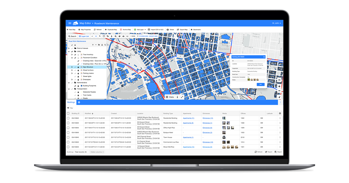
GIS data is often used to train these models. In GIS Map Editor, the attributes and spatial properties of the training data of these models can be created. By improving your GIS data, your AI model will improve as it feeds more accurate training data.

Network Optimization
Networks exist all over the world. They exist as road systems connecting cities, people, and industries. Underneath these surface networks are miles of utility networks and other crucial infrastructure.
Networks can also exist in single buildings, such as wastewater treatment plants and electric power plants.
These networks rely on efficiency and predictability. Once simplified, they can be viewed as points and lines. Each represents an important feature in their network.
Step number one is to design, create, and manage the features. This is where GIS comes in.
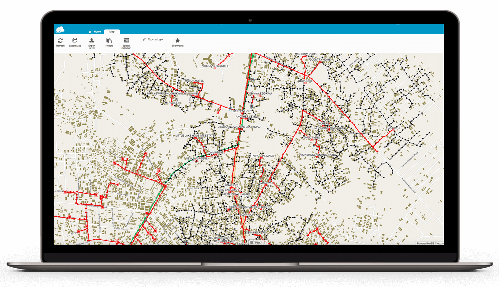
In GIS Cloud, the features can be created to engineering standards with the important attributes associated. Points representing valves, connections, or traffic lights can stop flows or serve as transition points.
The lines of the network show the flow and connectivity. Their attributes can represent the speed, volume, starting and ending inverted elevations of the pipes, or other linear features. This information describes how things move throughout the network.

After creating these features in GIS Cloud, they can be moved into an AI model.
Within an AI model, the possibilities are endless. You can simulate real-life events.
Simulating a pipe bursting or planned construction can be used to understand how to work around these inconveniences. With a pipe failure, the AI model can identify which valves need to be shut off to isolate the issue.
During a construction simulation, the modifications can be tested on the system at their most extreme capacities. This stress test can find problem areas in the system and show how the construction or improvements will impact the proposed fixes.
Learning how to handle crises without the need to experience one is invaluable. The crises are only limited by your imagination.
IOT Data Integration
Internet of Things (IoT) devices are sensors or data collectors connected to the internet. These may be your home security system or home thermostat, your front door’s lock, or even your refrigerator.
In many commercial industries, these devices are being integrated all over. They are used as traffic monitors, temperature gauges, access point monitors, water flow readers, vehicle trackers, and various health condition monitors.
These IoT devices can be connected to an AI application that provides powerful solutions and predictive modeling.
An AI application can detect anomalies, patterns, and potential failures in the systems of these IoT devices. These detections can identify problems, present the required solution and stay ahead of the issue.
In farming applications, soil sample sensors can detect the amount of water and temperature of the ground. This can set off an automated response through an AI. The sensor provides the current state of the ground, and the AI collects that information and then makes an educated decision.
The AI may look at the forecast of the area for rainfall. Finding no rainfall in the immediate forecast, the AI will start the irrigation process earlier and increase the flow to accommodate for the lack of rain.
Traffic managers have been using AI technology to manage traffic flows. Sensors identify cars stopped at intersections and trigger the traffic lights to maintain a steady flow or pace cars to delay traffic jams at the next intersection.
These IoT devices can use AI to make rapid and intelligent decisions. Using GIS to create accurate data tied to these devices can ensure the AI comprehensively understands the system involved.
Site Optimization
Location! Location! Location!
Where you set up your next brick-and-mortar store for your business or where you decide to live can be answered with AI.
Identifying these important locations can be done through different spatial analyses on GIS Cloud.

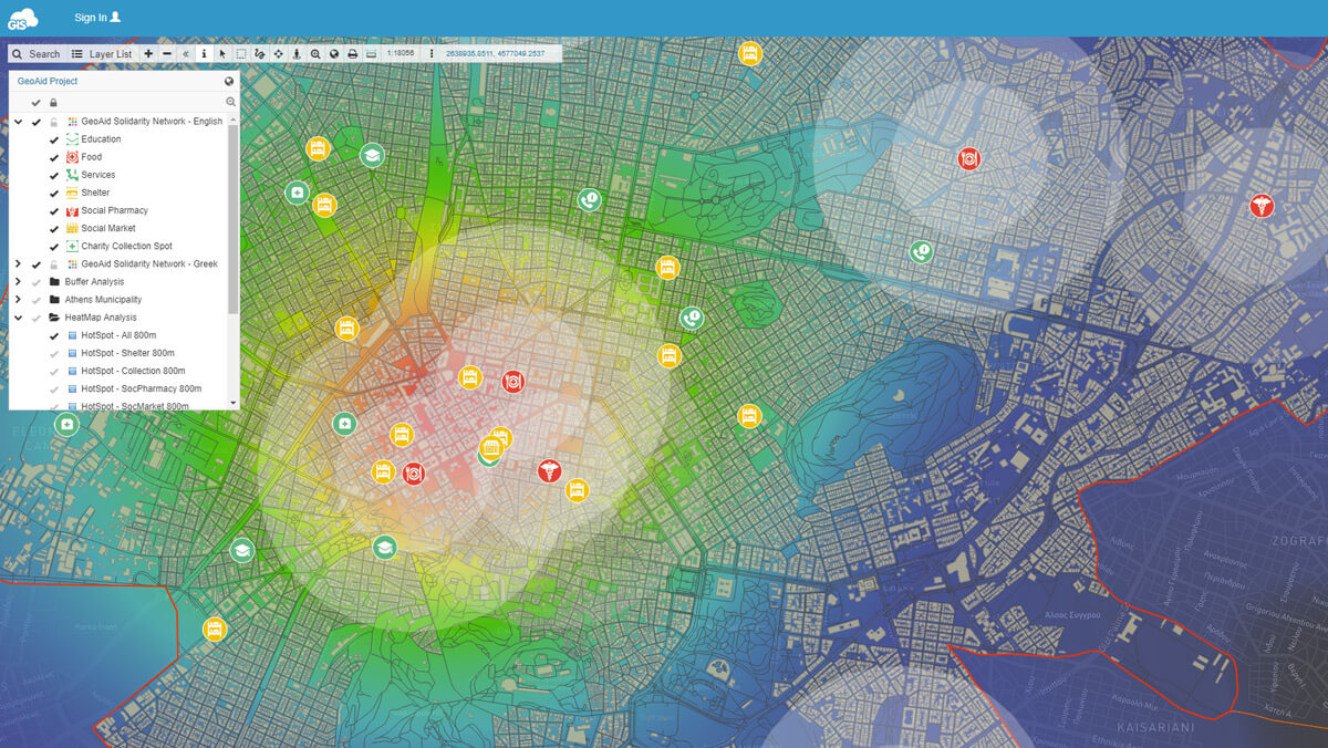
Running a buffer analysis within Map Editor will identify locations inside or outside the analysis areas. This is the beginning of the analysis required to find the best location to attract your customers. You can run this analysis on your parcel and zoning data.
AI can expedite this process based on your GIS data. Analyzing your target customer’s demographics, proximity to locations, and existing competition will pinpoint where you need to focus your business.
For house shopping, the AI can identify your forever home’s ideal location based on your criteria. It can find a home close to great schools for your children, an easy commute to work for you and your spouse, far away from the in-laws, but close enough to museums and parks that you know your family would enjoy.
Supported by strong GIS data, an AI can perform a site optimization analysis to meet your location needs.
Conclusion
GIS has been around for many years, while AI is a developing and rapidly growing field. Combining the two of these powerful tools will unlock an infinite number of possibilities.
GIS Cloud can be a great tool for preparing your spatial data for AI.
Signing up for a free 14 day trial gets you all the premium features included with our Map Editor packages. If you have any GIS Cloud or AI integration questions, our solution consultants are available to help you succeed.


