Have you ever felt like you’re navigating a maze when dealing with Geographic Information Systems (GIS)? Well, you’re not alone. GIS is a fascinating world, full of potential, but it can also be a bit overwhelming, especially if you’re starting out. But fear not! This guide shines a light on those common GIS pitfalls and shows you how to turn them around.
GIS isn’t just about maps and data; it’s a powerful tool that shapes decision-making in urban planning, environmental conservation, and even in our daily commutes. However, as with any complex tool, it’s easy to stumble, especially if you’re new to this game. From misunderstanding basic concepts to fumbling with the wrong software, these mistakes can be more than minor setbacks. But here’s the good news: every mistake is an opportunity to learn and grow.
In this guide, we’ll explore the ‘oops’ moments you might encounter in your GIS journey and, more importantly, how to fix them. Whether you’re a student, a professional, or just a curious mind, you’ll find tips and tricks to make your GIS experience smoother and more productive. So, let’s dive in and turn those GIS blunders into your stepping stones to mastery!
Understanding the Basics of GIS
First things first, let’s break down what GIS is. At its core, GIS is all about visualizing and interpreting data to grasp spatial relationships and patterns. It’s not just about maps but the data behind them, from bus stop locations to wildlife migration routes. Key concepts include:
- Spatial Data: The backbone of GIS, encompassing all geographically referenced information.
- Layers: Different types of data stacked together for a comprehensive view.
- Projections: Essential for accurately translating our round Earth onto flat maps.
- Analysis: Using GIS for practical solutions, like finding the perfect spot for a telecommunication tower or utility line.
Understanding these basics is crucial, so dive in, experiment, and embrace the learning process!
Data Collection and Management
Data is king in the vibrant world of GIS, and how you collect and manage it can make or break your project. This is where Mobile Data Collection and Map Editor step in as game-changers.
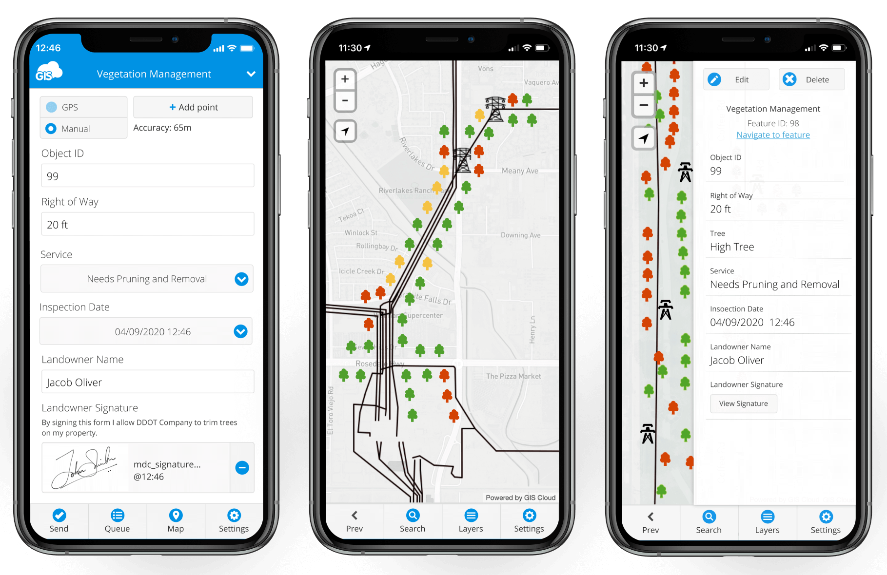
Mobile Data Collection transforms how we gather data. Imagine equipping your field teams with smartphones or tablets, enabling them to capture real-time, accurate data directly from the source. It’s not just about convenience; it’s about enhancing data quality and speed of collection. Whether marking a new urban development on the map or tracking wildlife in remote areas, this tool ensures your data is as current and precise as possible.
Meanwhile, Map Editor is the unsung hero in the data management saga. It’s an intuitive platform that allows for seamless editing and updating of maps. You can add new layers, adjust features, or refine details, ensuring your maps are informative, aesthetically pleasing, and easy to interpret.
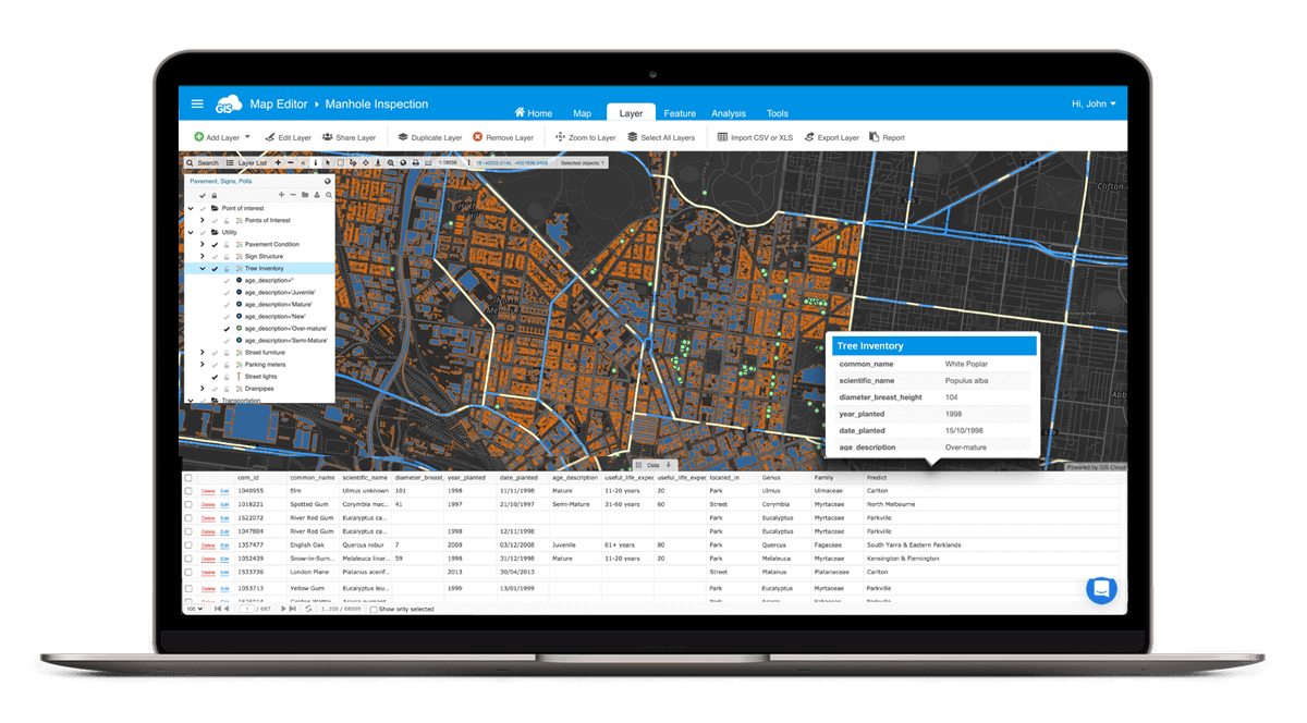
Both tools empower you to handle data with greater efficiency and accuracy, turning the often-daunting task of data collection and management into a smoother, more enjoyable part of your GIS journey.
With these tools in your arsenal, you’re not just collecting and managing data but crafting a dynamic, up-to-date narrative of the world.
Choosing the Right GIS Software
When diving into the world of GIS, picking the right software can feel like a maze. You’ve probably heard of heavyweight contenders like ArcGIS, but let’s not overlook the innovative hybrids like GIS Cloud.
These nimble platforms are shaking things up by offering functionality similar to the big guys but at a fraction of the cost. Imagine the flexibility of open-source tools like QGIS, seamlessly integrated with cloud-based powerhouses for collaboration and server management. GIS Cloud shines here, blending in with your existing systems and enhancing them without overhauling them.
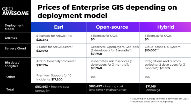
It’s a real game-changer, especially if you’re budget-conscious and seeking agility in your GIS journey. It’s not just about the tool but how well it fits into your world of maps and spatial analysis!
Map Design and Visualization
When it comes to map design, simplicity reigns supreme. A cluttered map is like a crowded room – overwhelming and confusing. Strive for clarity by focusing on essential elements and using contrasting colors judiciously. Your map should strike a balance, not resemble a rainbow.
Symbols and scales are pivotal in map design. Opt for easily recognizable symbols and maintain a consistent scale. Remember, your map is a communication tool, not a canvas for abstract art. Additionally, a thoughtful layout ensures a smooth visual journey from one point to another.
GIS Cloud’s Map Viewer transforms this process. Its intuitive interface demystifies map-making, catering to both beginners and experts. With real-time visualization, you see the immediate impacts of your design decisions, an essential feature when handling complex spatial data. Map Viewer simplifies your workflow, allowing more time for creative expression.
Its capabilities extend to supporting various data formats and offering diverse styling options. This adaptability enables the creation of informative and visually appealing maps.
Integrating Map Viewer into your GIS toolkit elevates your map design, ensuring your data is communicated clearly, compellingly, and insightfully. Keep these principles in mind, and your maps will not only inform but also impress.
Spatial Analysis Techniques
Spatial analysis is where the real magic happens in GIS. It allows us to uncover patterns and relationships in our data that aren’t immediately apparent. Think of it like being a detective but for maps!
First up, let’s talk about basic techniques like buffering and overlay. Buffering creates a zone around a map feature – which helps determine areas affected by a particular phenomenon. Overlay, on the other hand, lets you stack different layers of data, revealing how they interact. Imagine discovering where a rare bird’s habitat overlaps with planned construction sites – crucial for environmental planning!
Here’s where many beginners trip up: choosing the wrong method for their data. Always ask, “What do I want to find out?” Your analysis technique should directly answer this question. And remember, simpler is often better. You don’t need complex algorithms to get meaningful insights. Sometimes, a basic query does the trick!
Integrating GIS with Other Technologies
Think of GIS as a friendly neighbor to your existing systems. It’s not about replacing what you have but making it shine brighter!
Enter GIS Cloud, the star of this integration show. It’s like a nifty gadget that connects seamlessly with your current setup, giving it a superpower boost. GIS Cloud is your go-to whether you deal with huge datasets or need creative map styling. It’s all about working smarter, not harder.
This integration isn’t just a fancy add-on; it’s a game-changer for data analysis and decision-making. Imagine having all your tech in harmony, singing the same tune. That’s the magic of integrating GIS Cloud.
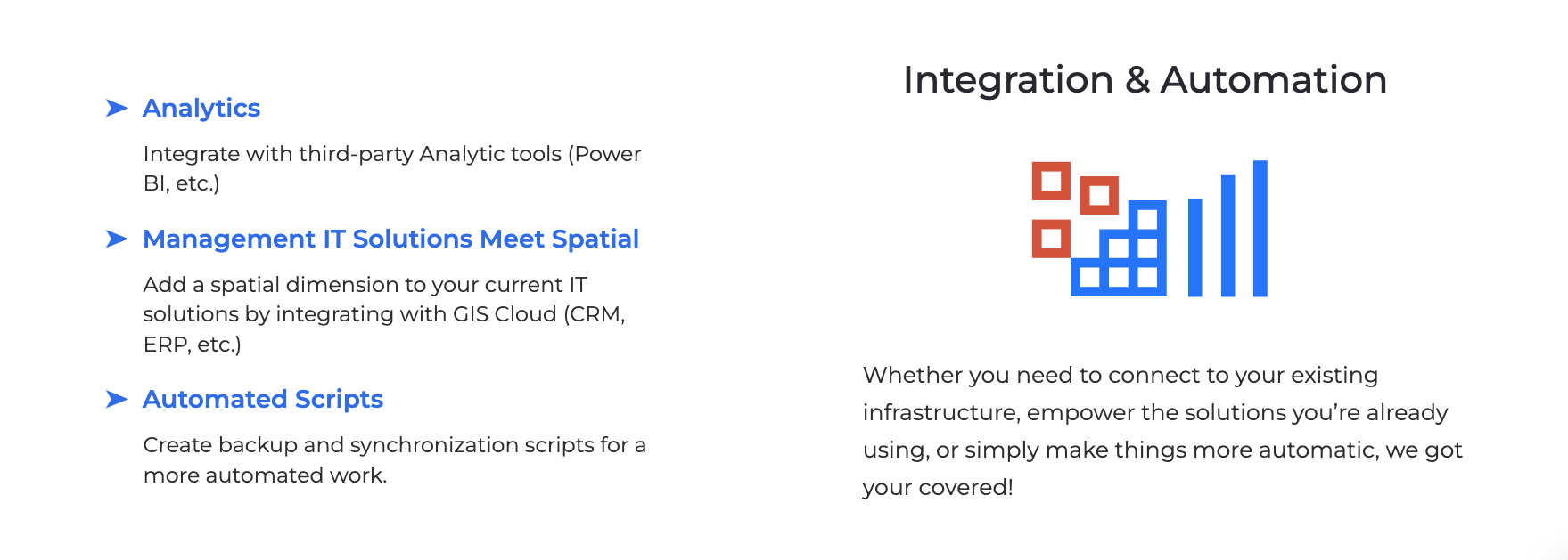
So, embrace this blend of technology and watch your GIS projects transform into something extraordinary!
Keeping Your Skills Updated
To stay ahead in the rapidly changing GIS field, continuously updating your skills is essential. GIS Cloud’s Webinars and Education courses are excellent for this purpose. Along with GIS Cloud’s Learning Center, they provide a range of materials suitable for everyone, from novices to seasoned professionals, ensuring access to a comprehensive and user-friendly learning environment.
Their interactive webinars offer insights into the latest GIS features and applications, while in-depth courses cover fundamental GIS principles. Engaging with GIS Cloud’s educational offerings broadens your knowledge and connects you with a community of GIS enthusiasts and experts.
Additionally, attending workshops and conferences is highly beneficial for learning new concepts and networking. Stay curious, keep learning, and you’ll be a GIS pro in no time!
Conclusion
Well, there you have it – your roadmap to mastering GIS! Remember, GIS is a journey, not a destination. Each step, whether choosing the right software like GIS Cloud or mastering map design, is a chance to grow and improve. Embrace your mistakes, learn from them, and keep pushing forward.
The beauty of GIS lies in its power to reveal the hidden stories in our data, helping us make smarter decisions and understand our world better. So keep experimenting, stay curious, and most importantly, enjoy the process. You’re not just dealing with maps and data; you’re shaping the future, one layer at a time.
And hey, if you ever feel stuck, remember this guide. We’ve tackled the basics, the pitfalls, and the strategies to make your GIS journey rewarding. So go ahead, dive in, and let your GIS adventure unfold. The world of spatial analysis is waiting for you, and it’s more exciting than ever!
If you’re keen to explore GIS Cloud and see how it can transform your GIS projects, reach out to our Solution Consultants. Try GIS Cloud for free with our 14-day trial and experience firsthand the power of smart, integrated GIS solutions!


