Civil engineering covers various disciplines, from impressive structures to critical water distribution infrastructure and sensitive environmental resources.
Each of these play an important role in society. Failures in either could have a devastating impact on society and the environment. Properly constructing and maintaining these assets is essential.
Let’s explore how GIS Cloud can improve the workflows of different civil engineering projects.
If any of our many solutions interest you, we invite you to sign up for a free 14-day trial with all our premium features available to you and your team. Our solution consultants would happily connect and give you a software demo.
Project Cycle
Civil engineering projects involve a lot of moving parts as they develop. Project design and environmental analysis must be completed before the shovels break the earth.
Collecting and storing your data in an online GIS Solution will keep the data in one place while giving all involved access. The Map Editor can share the map, control the permissions and decide who can change the data.
GIS Cloud can also connect to external databases with a REST API.
As a project gets underway, changes on the ground can be monitored in multiple ways, including using the Mobile Data Collection app (MDC) or capturing aerial imagery with drones.
Combining boots on the ground and eyes in the sky, you can track the process of all your projects without missing any developments.
As projects reach completion, the data can be used in asset inventory management systems or monitoring efforts.
GIS Cloud can support a number of disciplines under civil engineering.
Traffic Engineering
Everyone is happier when traffic flows smoothly and efficiently. Combining GIS and traffic engineering can make this difficult task more manageable.
The US Manual of Uniform Traffic Control Devices document is a traffic engineer’s Bible. In the United Kingdom, they follow the Traffic Signs Manual. Following the guidelines of these will improve the flow of traffic.
Traffic signs are essential in communicating to drivers the information they need to know. This can include road speeds, road conditions ahead, construction/school zones, and services in the area.
Collecting asset inventories can be a significant undertaking without the proper tools. The Mobile Data Collection app, Map Editor, and Map Viewer will speed up the process.
An initial sign inventory captured with the MDC app might include attributes along the lines of sign type, condition, install date, a night reflectivity score, in compliance? (Y/N), pole type, and attachments of photos of the signs and their surroundings.
Comparing your existing sign inventory to the traffic code will guide you in what changes you need to make. As work orders are completed in the field, the changes made in the MDC app will update instantly for those using the MDC app.
If the area has poor cell coverage, the maps can be downloaded for offline use and synced once they get better cell service.
Point data can be easily mapped and managed in GIS Cloud whether you are a GIS pro or someone just discovering GIS.
Storm Water Systems
Stormwater systems move rainfall and water runoff from properties and roadways to ponds and other bodies of water. Keeping these pipes and drains clear of debris is an ongoing task and requires periodic maintenance and cleaning.
Knowing the location of your storm drains and manhole is an important function in a well-run system. Looking at your system in a 3D environment helps show where the direction of flows is going.
In GIS Cloud’s Map Viewer, you can look at your data in 3D with a single click.
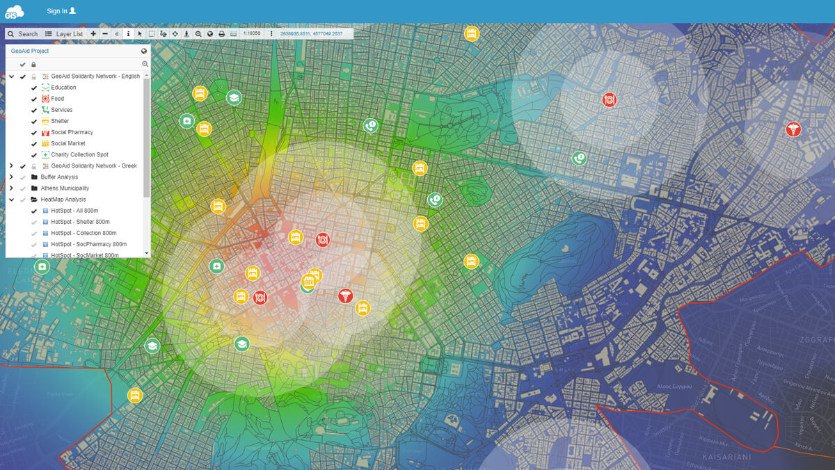
In a 3D GIS environment, the low spots and potential problem areas can be identified. Maintenance information collected in the Mobile Data Collection app can also show where frequent problem areas occur by symbolizing the data with a heat map.

A complete view of your system will give you a better understanding of how the system flows and locate inefficiencies.
By attaching links to the storm features, you can review the as-built plans associated with that specific feature and get further details.
We recommend capturing the different inverse elevations if they are available on the plans. These elevations can be used to determine how fast the stormwater flows down the system. It will also help locate the pipe by knowing its correct depth.
Polyline data is a simple type but can prove useful when viewed in 3D and depth information is captured as attributes.
Legal Boundaries
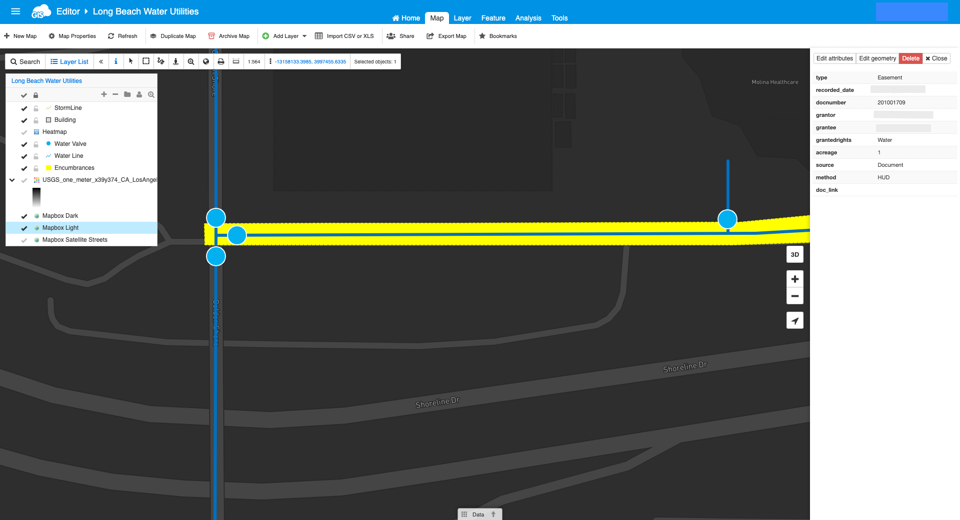
Legal boundaries and encumbrances is information collected in the planning stage of the engineering project cycle. Once you have mapped your easement locations and your utilities, you can do a gap analysis.
This analysis will compare where your legal rights exist versus where your current and proposed utilities are located. Resolving these issues will be necessary for each of the stakeholders involved in the project.
My favorite way to do this is to map the legal boundaries of the georeferenced TIFFs brought directly into GIS Cloud or import the shapefiles provided by the title company or engineering firm.
In the attribute table of the easements, we recommend pulling information directly from the recorded document tied to the easement.
You may want to include things like recorded date and type of document. Is it a Grant Deed giving permission from one person to another? Or is it a Quit Claim, and the rights are being revoked?
Collecting the document number will make it easy to track county records or link between documents. Attaching the document directly to the mapped easement is a great idea.
Viewing the recorded document in the Map Portal is helpful for those researching the project.
We recommend adding other details to the attribute table, including the Grantor, Grantor, granted rights (water, utility, access), document status, and the legal easement’s dimensions.

A comprehensive attribute table may require more work initially, but it pays dividends.
Users of your Map Portal, which you can customize with your brand, can identify the encumbrances and view the details of the recorded documents.
When the spatial data is brought into the map or portal viewer, capturing this information gives stakeholders all the necessary information. If there are any issues related to legal rights, they know which “Grantor” or “Grantee” they need to get in touch with.
Sometimes a waterline gets installed in an easement, only allowing stormwater. Your gap analysis will identify this issue and allow you to resolve it before it becomes a larger problem.
Environmental
We are dependent on the environment and must respect its natural power. Using contours and terrain data can help us improve our surroundings and understand the environment.
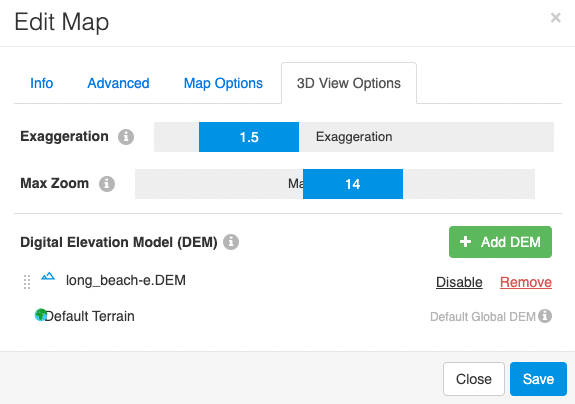
In a 3D view, we can see the contours and slope areas. The Map Editor even allows you to bring in your own DEM.
We can also import GeoTiffs, JPEG2000 files, KMLs, shapefiles, and other spatial file types in the Map Viewer through the File Manager tool.

Combining different data will give you a complete understanding of the ground situation. The 3D model can also serve as another tool for analyzing the environment.
The dramatic slopes of hillsides can be used to identify potential mudslide areas. Combined with the soil types in the area will improve the risk assessment.
Adding the soil information and adjusting the data symbology with hatches or transparency can give you a clearer view of the situation.
You will be able to see which permeable soils are near fault lines and if recent fire burn areas might be additional factors.
This analysis can be done to protect homes, roads, and other infrastructure in the vicinity.
Conclusion
An online GIS solution like GIS Cloud can support civil engineering projects regardless of their discipline.
By building an accurate spatial model and accurate attribute table, the return on investment is impressive. The hard work of field crews and those on the ground can be communicated directly to project managers and stakeholders through the GIS Cloud ecosystem.
If you’d like to see a demo with one of our experts, contact us, and we will be in touch shortly.
We offer a free 14-day trial if you want to try GIS Cloud. The trial includes our premium features, including the 3D viewer and Map Portal.


