One of the cloud-based GIS applications in creating a smart city and a more responsive and sustainable environment is in public health. Increasing urbanization and a significant growth of international transport of people and goods creates unique challenges for the disease control and prevention in urban areas.
These challenges are not new, nor are the means to solve them – as you probably know, we can trace the first successful attempts at mapping the disease back in the 19th century. It was when the British doctor John Snow prevented the further spread of the cholera outbreak in London by mapping its incidences. Those incidences were traced back to a single source of contaminated water – a water pump at the Broad Street.
Today we have much more advanced technologies for disease control and prevention as well as the other aspects of public health than ever before. GIS Cloud technologies are just beginning to show their potential applications in various projects driven by the incentive to create more sustainable future for the urban population all around the world. One such example is the MetaSUB (The Metagenomics and Metadesign of the Subways and Urban Biomes) project.
The project
MetaSUB was launched by Mason Lab at Weill Cornell Medicine, as an interdisciplinary initiative whose goal is to integrate microbial ecosystems into the design of cities. Their goal is to find out more about the complex microbiome lying on the surface of public transit systems all around the world. The researchers want to use this knowledge to improve city design, planning, and public health and contribute in building more responsive and smarter cities.
The initiative started with the pilot project called PathoMap, launched in 2013 in the New York City subway system. In 2016, this pilot has expanded into the global MetaSUB project.
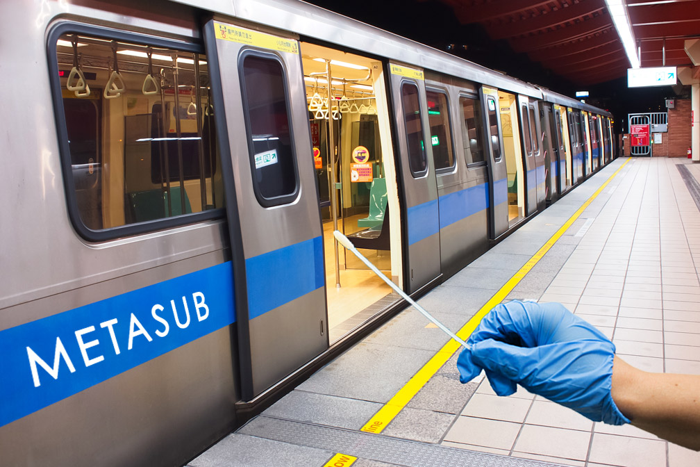
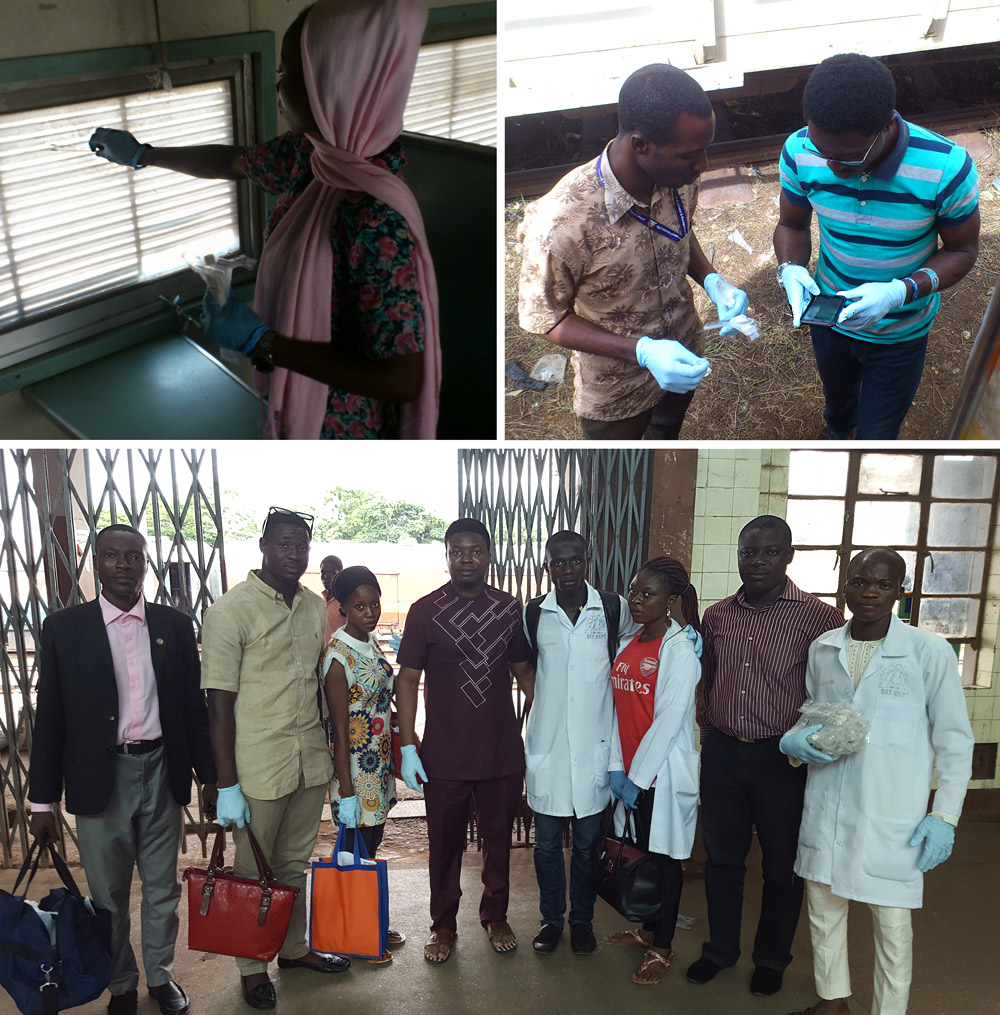
On June 21st, 2016, researchers from more than 58 cities all around the globe were swabbing public transit surfaces such as emergency exits, ticket kiosks, benches, stairwell handrails, garbage cans and elevators, as well as inside of trains, buses, and mass-transit hubs.
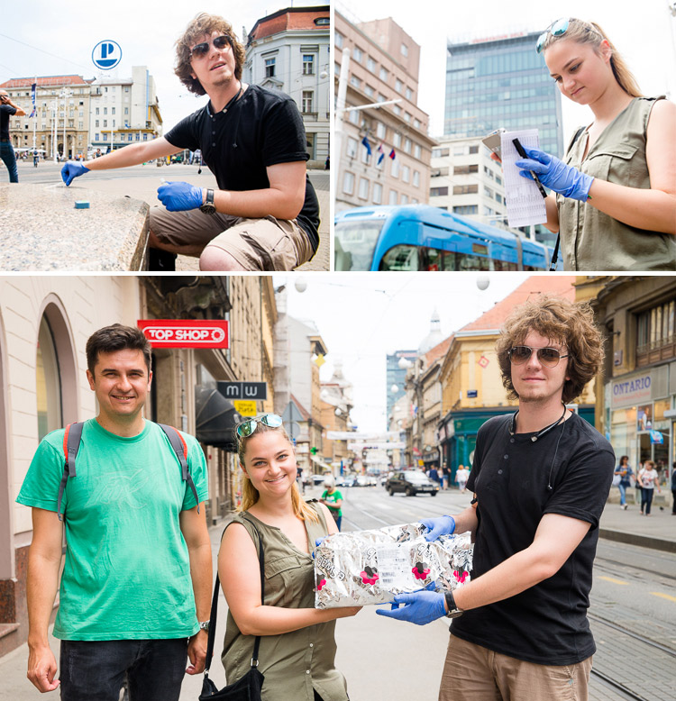
Zagreb, Croatia
The geospatial component is an important part of the research – its results will be displayed in metagenetic and forensic maps that will help in discovering new species and biosynthetic gene clusters. Also, they will map pathogens such as viruses and bacteria together with Anti-Microbial Resistance Markers in public transits in different parts of the world.
Challenges
Of course, undertaking the simultaneous mapping project in more than 58 cities around the world brings its challenges. In the data collection phase of the project, it was important to ensure a strict methodology that would guarantee good data quality. Using old data collection methods, like doing paperwork and adding data manually to a map (especially multimedia), for more than 100 locations across each city, would be an impractical solution that would also take too much time.
Moreover, paper-based forms bring unpredictable results because it is not easy to control if all the necessary data is there. At the same time, written form also isn’t precise enough for capturing the exact GPS location and time when data was collected. Of course, paper data could be lost and isn’t the most convenient way of adding an extensive amount of information to a map.
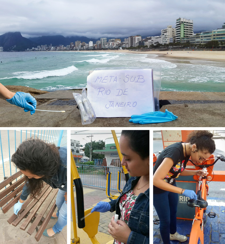
Rio De Janeiro, Brazil
Except the methodology, one other common problem occurring in mapping projects operating on a global scale is coordination with and between the field crews. To get a complete picture of different transit spots in the cities, it is important to have a good overview of transit routes and to be able to make on-site decisions if something unpredictable happens.
Having this in mind, an alternative approach to data collection consists of using mobile applications that could help in doing all the work. This brings different kind of challenges such as no internet connectivity in some areas and training data collectors who do not have previous mapping experience to use new methods.
Methodology
As we stated in previous paragraphs, the geospatial dimension of the MetaSUB project relies on precise field data. For practical reasons, researchers working on the project decided to collect necessary sample data with mobile devices (smartphones and tablets). As it was important to have an ability to coordinate activities in different places, they choose GIS Cloud mapping system that will allow them to observe and collect data in real time. Also, choosing cloud-based platform solved the problem of having to add all data and multimedia manually, which would require a significant amount of time. These challenges are not uncommon when we talk about fast-paced urban environments that require a high level of responsiveness. Uploading data directly to a cloud saves a lot of time while ensuring better decision-making based on accurate real-time data.
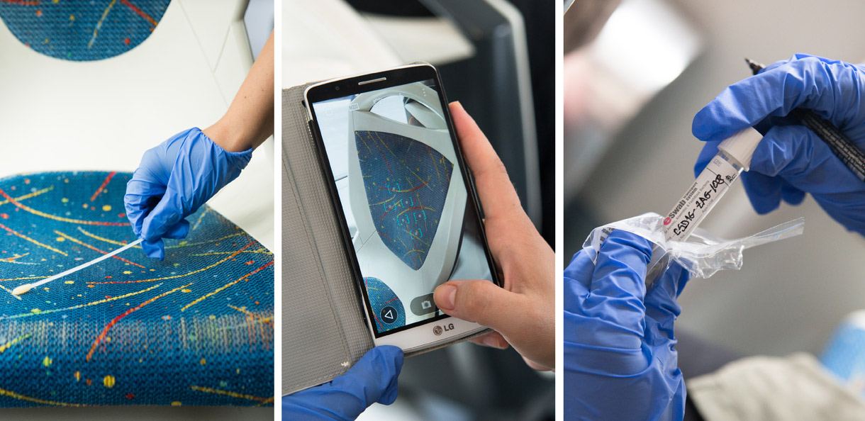
Zagreb, Croatia
The first event of the worldwide swabbing action on June 21, 2016 was a great success, using GIS Cloud Mobile Data Collection application. Cloud-based GIS platform enabled the researchers to capture data in real-time and have it instantly visible on a map in a web browser. This means that real-time data could be accessed by different people from any location in the world. The web map data was accessible through any device (mobile, tablet, laptop), which is practical when you need to monitor a project taking place in different time zones.
Data Collection process
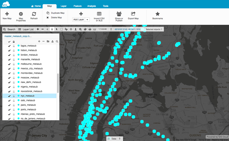
To begin with, surfaces inside of the vehicles and on train stations of the each transit system were swabbed. After swabbing, relevant data, such as location and time stamps (collected automatically), sample ID, surface, traffic level, notes, and pictures were added through the forms in the Mobile Data Collection app. This information was visible on a dedicated point layer of web map showing the swabbing process in real time.
Marseille, France
Different form sets are also available for other public surfaces such as buses, taxis, parks, and airports. Each collector opened data collection form and added the required info. To avoid missing data, all required fields had to be filled before sending information on a map. This was an important step in ensuring good data quality. Also, GPS and time stamps were added automatically for the maximal precision. Another important aspect was that collectors anywhere in the world used the same collection forms to get a complete picture of the environmental factors relevant for understanding sample results.
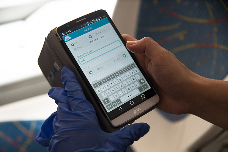
The forms were easy to use for anybody who knows how to operate a smartphone or a tablet. Ease of use meant that there was no need for additional staff training thus saving time and money, and this was especially important on a project of such a large scale.
Having all this data available in the cloud solved the challenge of coordination and decision-making. For example, In Zagreb (Croatia), routes were planned considering the local temperatures on particular train stations.
The additional benefit of cloud-based GIS system was that all this data could be published on the web for anyone who wants to see how the project is progressing.
So, after sample data is collected, it is instantly visualised on a map and can be published to a Map Portal for public viewing with the help of the Map Editor app.
We can conclude that spatial visualisation and map-based data collection can bring together various aspects of elements vital for cities around the world: transport and traffic, emergency response, disease control and prevention, smart architecture, and design. The responsiveness of cities and local communities can be significantly increased through cloud mapping collaboration system that works in real-time and is accessible through all devices. Mobile Data Collection combined with web mapping and collaboration apps can play an essential role in building smarter cities.
Applications used:
Interested in GIS Cloud solutions for Smart Cities? Contact us at: smartcities@giscloud.com
Links to other Smart City resources:
- GIS Solutions for Smart Cities webinar recording
- Geospatial Technology for Building Smarter Cities
- How to Transform your City Public Works in a Few Simple Steps webinar recording
- GIS Cloud Smart Cities – City Portal webinar recording


